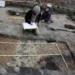


During the Project: Polish-Norwegian Modern Archaeological Conservation Initiative “Archaeology of Yatvings” a geodetic survey was carried out at the settlement complexes at Skomack Wielki (Ostrów) and Szurpiły. The fieldwork was led by M. Jaworski and included the following:
- developing a control network for the settlement complex at Skomack Wielki (Ostrów),
- obtaining supplementary input to the control network developed for the settlement complex at Szurpiły,
- measurements made during a surface survey with metal detectors of both complexes,
- developing a measuring grid for the geophysical survey of both complexes,
- developing a control network needed for the geomorphology work at Skomack Wielki (Ostrów),
- measuring the differences in elevation at Skomack Wielki (Ostrów) and using this data to develop a contour map,
- planning the location of archaeological trenches in both sites.
Ultimately the geodetic survey was made for 18.70 ha at Skomack Wielki (Ostrów) and for 10.2 ha at Szurpiły. Instruments used included RTK Trimble 5800 GPS and Leica TC 407 Total Station. Coordinates X and Y were measured using the 92 datum, elevations – H using the Kronsztad 86 height datum.